This page introduces Geo-spatial functions that treats latitude and longitude.
Note
This feature is supported from Hivemall v0.5-rc.1 or later.
Tile number function
tile(double lat, double lon, int zoom) returns a tile number in xtile(lon,zoom) + ytile(lat,zoom) * 2^n. The tile number is in range [0,2^2z].
Formulas to convert latitude and longitude into tile x,y coordinates are as follows:
{% math %} \begin{aligned} x &= \left\lfloor \frac{lon + 180}{360} \cdot 2^z \right\rfloor \ \ y &= \left\lfloor \left( 1 - \frac{ \ln \left( \tan \left( lat \cdot \frac{\pi}{180} \right) + \frac{1}{\cos \left( lat \cdot \frac{\pi}{180} \right)} \right) }{\pi} \right) \cdot 2^{z - 1} \right\rfloor \end{aligned} {% endmath %}
Refer this page for detail. Zoom level is well described in this page.
Usage
WITH data as (
  select 51.51202 as lat, 0.02435 as lon, 17 as zoom
  union all
  select 51.51202 as lat, 0.02435 as lon, 4 as zoom
  union all
  select null as lat, 0.02435 as lon, 17 as zoom
)
select
   lat, lon, zoom,
   tile(lat, lon, zoom) as tile,
   (lon2tilex(lon,zoom) + lat2tiley(lat,zoom) * cast(pow(2, zoom) as bigint)) as tile2,
   lon2tilex(lon, zoom) as xtile,
   lat2tiley(lat, zoom) as ytile,
   tiley2lat(lat2tiley(lat, zoom), zoom) as lat2,  -- tiley2lat returns center of the tile
   tilex2lon(lon2tilex(lon, zoom), zoom) as lon2 -- tilex2lon returns center of the tile
from
   data;
| lat | lon | zoom | tile | tile2 | xtile | ytile | lat2 | lon2 | |:-:|:-:|:-:|:-:|:-:|:-:|:-:|:-:| | 51.51202 | 0.02435 | 17 | 5712445448 | 5712445448 | 65544 | 43582 | 51.512161249555156 | 0.02197265625 | | 51.51202 | 0.02435 | 4 | 88 | 88 | 8 | 5 | 55.77657301866768 | 0.0 | | NULL | 0.02435 | 17 | NULL | NULL | 65544 | NULL | NULL | 0.02197265625 |
Distance function
haversine_distance(double lat1, double lon1, double lat2, double lon2, [const boolean mile=false]) returns Haversine distance between given two Geo locations.
-- Tokyo (lat: 35.6833, lon: 139.7667)
-- Osaka (lat: 34.6603, lon: 135.5232)
select
  haversine_distance(35.6833, 139.7667, 34.6603, 135.5232) as km,
  haversine_distance(35.6833, 139.7667, 34.6603, 135.5232, true) as mile;
| km | mile |
|---|---|
| 402.09212137829684 | 249.8484608500711 |
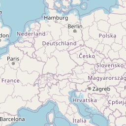
Map URL function
map_url(double lat, double lon, int zoom [, const string option]) function returns a tile URL of openstreetmap.com or maps.google.com.
The 4th argument takes the following optional arguments:
hive> select map_url(1,1,1,'-help');

usage: map_url(double lat, double lon, int zoom [, const string option]) -
       Returns a URL string [-help] [-t <arg>]
 -help             Show function help
 -t,--type <arg>   Map type [default: openstreetmap|osm,
                   googlemaps|google]
Usage
WITH data as (
  select 51.51202 as lat, 0.02435 as lon, 17 as zoom
  union all
  select 51.51202 as lat, 0.02435 as lon, 4 as zoom
  union all
  select null, 0.02435, 17
)
select
   map_url(lat,lon,zoom) as osm_url,
   map_url(lat,lon,zoom,'-type googlemaps') as gmap_url
from
  data;
